


Talk to an Expert

|
Dale Hylton - Sales Engineer 844-474-8833 x2 |
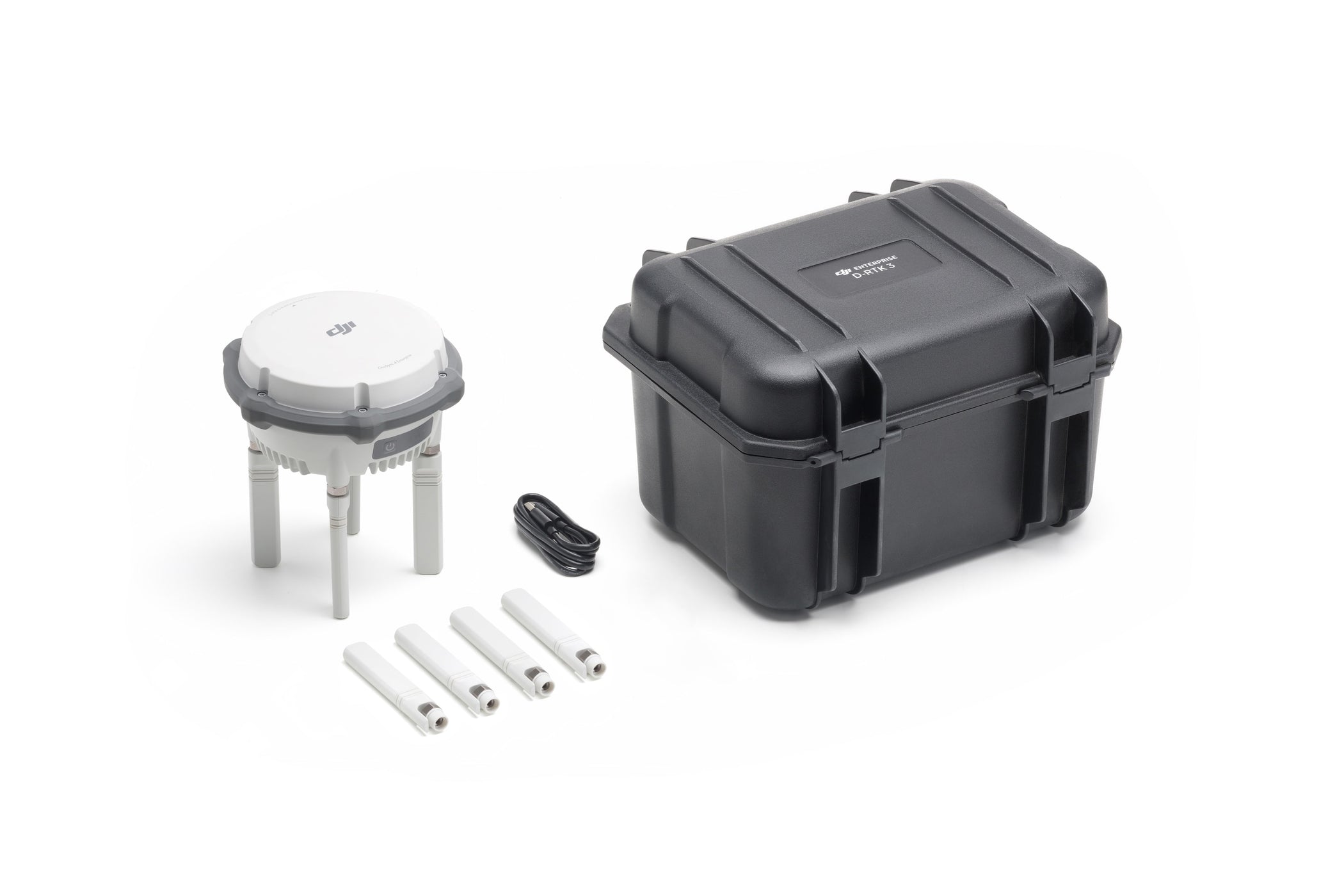
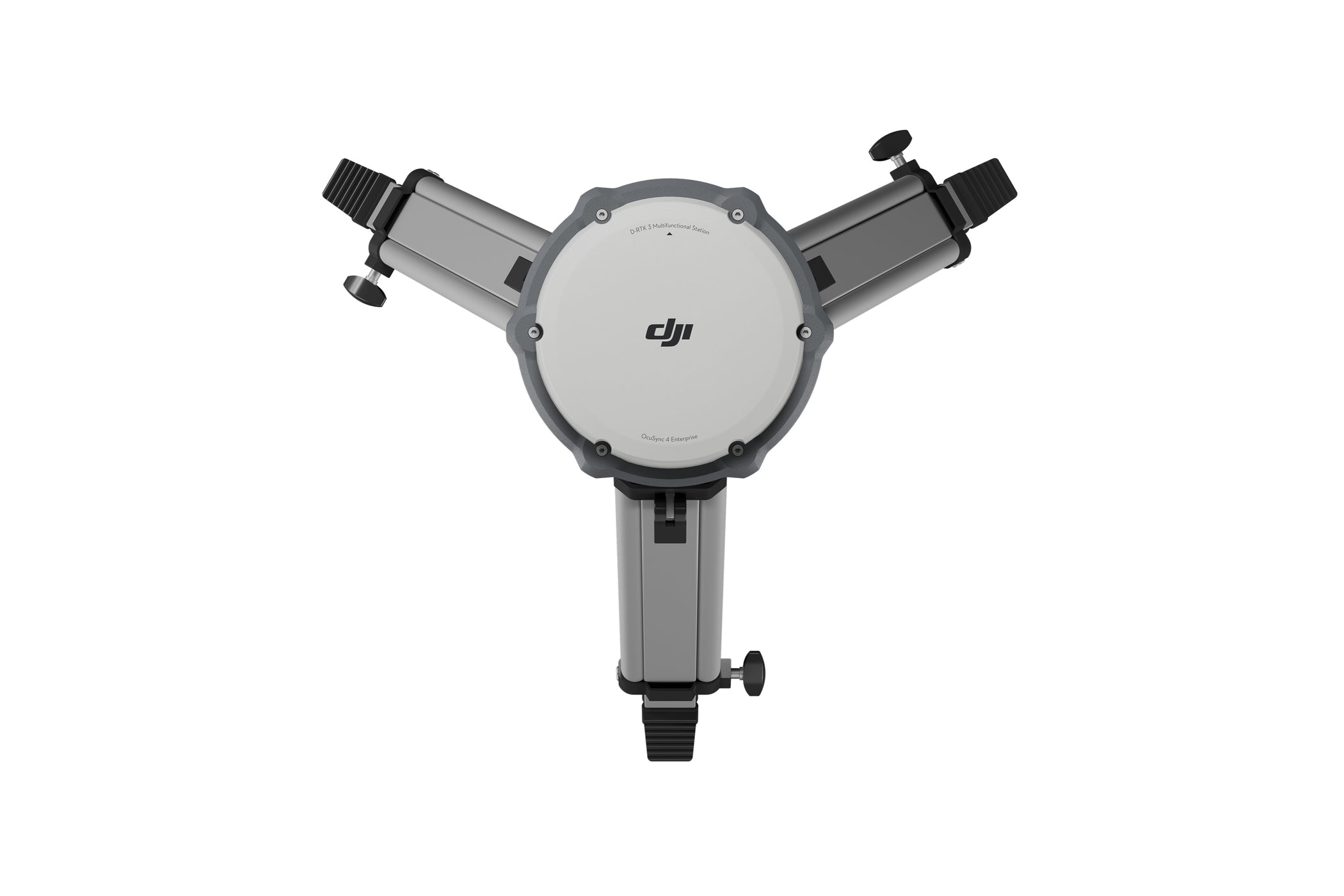
The game-changing D-RTK 3 Multifunctional Station by DJI has arrived, bringing groundbreaking precision and versatility to drone operations. Whether you're seeking high-precision positioning for surveying and mapping or need a reliable image transmission relay for inspection or search and rescue operations, the D-RTK 3 offers unparalleled performance and adaptability.
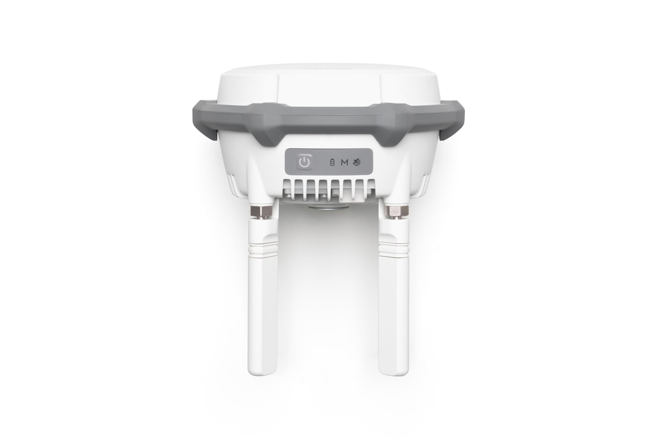
The D-RTK 3 Multifunctional Station is designed to meet the needs of enterprise users with its advanced components and features. It boasts high-performance air dielectric antennas with millimeter-level phase center accuracy, ensuring exceptional precision. The station supports data from five global navigation systems across 19 frequency points, offering extensive satellite compatibility. Its flexible transmission capabilities include Broadcast Mode, Relay Mode, and Rover Mode for adaptable operation. Additionally, it integrates seamlessly with DJI Enterprise drones, DJI Terra, and the DJI Enterprise app, making it ideal for mapping and precision tasks. Compatible with drone series such as the Matrice 4 Series, Matrice 300 RTK, and Mavic 3 Enterprise, the D-RTK 3 delivers unmatched versatility for enterprise operations.
Centimeter-Level Positioning for Maximum Accuracy
Precision is at the core of the D-RTK 3’s performance. With its advanced filtering antenna design, this system delivers reliable centimeter-level accuracy, even in challenging environments. Whether operating in urban areas with significant obstructions or remote locations with limited connectivity, the D-RTK 3 ensures exceptional precision. It supports standalone Precise Point Positioning (PPP), providing decimeter-level accuracy even in areas with weak internet connectivity. Additionally, it effectively manages multi-path interference while tracking low-elevation satellites. This makes it an ideal solution for high-precision applications like mapping, inspection, and 3D modeling.
Broadcast Mode - Seamlessly Manage Multiple Drones
The D-RTK 3’s Broadcast Mode allows multiple devices to connect simultaneously without additional configuration, making it ideal for businesses managing large drone fleets. With O4 Enterprise video transmission and directional antennas, it ensures stable video transmissions over distances of up to 15 km. This technology enables seamless multi-drone connectivity, providing precise positioning for all units. It is particularly useful for agriculture businesses coordinating drone fleets for crop spraying, as well as enterprises conducting multi-drone surveys, inspections, or emergency response operations.
Relay Mode - Extend Operational Range Beyond Limits
Relay Mode can support the new Matrice 4 Series. When deployed at an elevated location, it can potentially extend the operational range when there are obstacles between the RC and the aircraft. The system monitors obstructions in real-time and calculates optimal positions to ensure clear signals between drones, controllers, and relay stations. This feature is particularly useful for urban operations, where tall structures can disrupt signals, and for surveying remote landscapes such as mountainous terrains or deep valleys.
Rover Mode - Adaptability for Aerial Surveying
Flexibility is a key advantage of the D-RTK 3, which can also function as a rover station for precise control point coordinates collection during drone mapping projects. It works seamlessly with DJI Enterprise APP to efficiently create high-precision maps and simplifies workflows with tilt compensation, allowing measurements without needing the rover pole to be perfectly vertical. Additionally, it enables one-click export of ground control point data for processing in DJI Terra. Surveyors and cartographers will appreciate how Rover Mode enhances operational accuracy while significantly reducing setup time.
DJI Terra Integration - Streamlined Workflows
The D-RTK 3's integration with DJI Terra streamlines aerial surveying, making it faster and more efficient than ever. Data collected by the D-RTK 3 can be easily imported into DJI Terra for post-processing, enabling the quick generation of maps and 3D models. It supports both PPK (Post-Processed Kinematics) and RTK (Real-Time Kinematics) workflows, ensuring compatibility with various surveying needs. Additionally, it allows projection coordinate conversion, making it simple to output planar coordinates in mainstream formats. This seamless collaboration provides surveyors with a comprehensive end-to-end mapping solution.
Performance Highlights of the D-RTK 3
The D-RTK 3 Multifunctional Station excels in real-world scenarios where precision and flexibility are essential. It offers standout features such as ionosphere resistance, outperforming network RTK systems by maintaining stable operation even during ionospheric disruptions. Additionally, it supports multi-frequency access with 19 frequency points, providing greater reliability compared to single-frequency systems. Field tests have shown that the D-RTK 3 significantly reduces error margins in complex environments, setting a new standard for reliability and performance.
Elevate Your Drone Operations with the D-RTK 3
The DJI D-RTK 3 Multifunctional Station offers the ideal balance of precision, versatility, and technological innovation. Whether you're seeking high-precision positioning for surveying and mapping or need a reliable image transmission relay for inspection or search and rescue operations, the D-RTK 3 delivers cutting-edge solutions tailored to your needs.
Enhance your drone operations—order the D-RTK 3 Multifunctional Station today and experience the future of aerial positioning and surveying solutions.
Supported Models
Relay Station Mode [1]:
- Supports Matrice 4E/Matrice 4T
Broadcast Mode:
- Enterprise: DJI Matrice 4 series, DJI Matrice 3D/3TD (aircraft only)*, Matrice 300 RTK/Matrice 350 RTK*, Matrice 30 Series*, DJI Mavic 3 Enterprise Series*
- Agriculture: T60*, T50/T25*, T40/T20P*, DJI FlyCart 30*
- Professional Filmmaking: DJI Inspire 3*
[1]This feature is unavailable in countries or regions without 5GHz frequency support. Check local laws and regulations for more information.
* Currently, only manual D-RTK 3 position calibration is supported. Please refer to official updates for future feature enhancements.
Our on-line store is open 24/7 and we ship Monday through Thursday, excluding some holidays. Orders received for products without shipping restrictions on its product page will ship the same business day when received before 12:00 p.m. PST. Orders in high demand will have an estimated time listed on its product page and will ship according to the date listed.
Signature is required for most shipments.
*How long does it take for you to ship a product?*
This depends on your location, the method of shipping and the item you choose.
For in stock items inside the USA we typically ship by UPS and FedEx and for small items we ship by USPS. We typically ship items within 1-2 business days of the order for in stock shipment.
Ground Shipments can take up to 5 Business days from our Washington location. Express options are available by contacting us, but UPS and FedEx do NOT guarantee any shipments at this time.
If there are lithium batteries (most drones & ROVS), these cannot be shipped express.
USPS typically takes 2-3 business days for the smaller items by priority mail.
Special Order items can take time to arrive, but once they arrive we ship them out right away.
SHIPPING NOTES:
- Orders under $50 = $25 Ground Shipping & Handling
- Orders $50-499.99 = $20 Ground Shipping & Handling
- Orders $500 or higher = FREE Ground Shipping & Handling (USA Only)
- Alaska & Hawaii have unique shipping starting at $75
- Contact us for Express Shipping Options
- DHL & UPS Available for International Orders*
*International shipments are typically sent by DHL or UPS. Please note you are responsible for any customs fee, taxes and brokerage fees that may be due by importing an item into your country.

At Blue Skies Drones, your safety and confidence while flying are always a top priority. That’s why we’ve partnered with SkyWatch—a trusted name in drone insurance—to help ensure you’re protected every time you take to the skies.
Whether you're flying recreationally or professionally, SkyWatch offers flexible and affordable coverage options tailored to your needs. Choose from hourly, monthly, or annual plans, so you can fly with peace of mind—on your terms.
👉 Coverage available exclusively for customers in the USA and Canada.
![]()
Why Drone Insurance Matters – And Where to Get It
Flying a drone can be exciting and rewarding—but it also comes with risks. While drone insurance isn't always legally required, it’s highly recommended to protect yourself, your equipment, and others around you. Whether you’re flying for fun, professional photography, or commercial inspections, having the right insurance offers peace of mind and may be required by clients or job sites.
💡 Why You Should Consider Drone Insurance
🔹 Liability Coverage
Protects you financially if your drone causes property damage or injury to others.
🔹 Damage Protection
Covers repair or replacement costs if your drone is damaged due to crashes, hard landings, or environmental hazards.
🔹 Theft Coverage
Helps recover losses if your drone or gear is stolen.
🔹 Client & Regulatory Compliance
Many commercial projects, job sites, and government contracts require proof of insurance before allowing flight operations.
🔹 Peace of Mind
Know you’re covered—legally and financially—so you can focus on flying with confidence.
🛡️ Types of Drone Insurance
✅ Liability Insurance – Covers third-party injury and property damage.
✅ Hull Insurance – Protects your drone and payload (like cameras or sensors) from physical damage.
✅ Personal Injury Insurance – Covers medical costs for you or your crew during drone operations.
✅ Commercial Drone Insurance – Designed for businesses with multiple drones/operators, offering bundled and comprehensive policies.
📍 Where to Get Drone Insurance
-
Specialized Drone Insurers (like SkyWatch.AI)
-
General Insurance Providers with UAV policy options
-
Aviation Insurance Firms with experience in drone operations
⚖️ Is Drone Insurance Legally Required?
In the United States, the FAA does not require insurance, but many local governments, private clients, and commercial contracts do. It’s especially crucial if you’re flying professionally or in public spaces.
✔️ Before You Fly
Check with your current insurance provider to see if they cover drone rentals or flight operations. If not, we highly recommend securing coverage before you launch.
We’ve found that SkyWatch.AI offers affordable, flexible, and user-friendly options for drone operators of all levels.
Frequently Asked Questions
Do we offer Financing? The short answer is YES we do!
To determine the best financing option, we need to determine if you are interested in a personal financing option or if you will be using a business to finance your purchase.
 BUSINESS OPTIONS:
We work with 2 different companies for financing. Each Organization has their own criteria for purchases. These Financing options are for US customers only.
-
BNC Financial
Specializes in equipment funding from $500 and up. Follow this link to to the the financing application. -
First Pacific Funding
Financing options from $5000 and up. Follow this link to go to the financing application. - APPROVE Commercial Financing. Add an item to your cart, then click on the APPROVE logo for an inline application on the right hand of your screen. Monthly Payments and rates vary depending on final terms.
https://financing.approvepayments.com/blue-skies-drone-shop
 PERSONAL OPTIONS:
- Affirm
Buy now, pay later without the fees. Affirm is the smartest way to pay over time. Shop pretty much anywhere and pay at your own pace without any fees, so you can get the things you love without breaking your budget.
Affirm is built into our website. Click on the product you are interested in purchasing, then click on the 'Pre-qualify now' link.
Click Here to see the details on how it works -
Shop Pay
This payment option works similar to Affirm. If you do not see the shop pay option on the product page, click on "More payment options.
The Look for the button.